Puxton
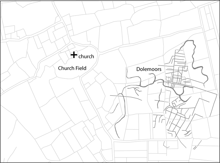
Puxton, North SomersetPuxton is a particularly fine example of a shrunken medieval settlement that began life as one of the first places on the North Somerset Levels to be recolonised following extensive post-Roman flooding. The earliest archaeology visible is in fact a Romano-British settlement on the Dolemoors (now a nature reserve run by the Avon Wildlife Trust: http://www.avonwildlifetrust.org.uk/), where slight earthworks, often marked out by different types of vegetation, lie on a different orientation to the modern field boundary pattern [see Figure 1]. These earthworks relate to two or more settlements associated with ditched field systems and a network of trackways, either side of a tidal creek (that also survives as a reed-filled depression). Excavations have shown that the settlements date to the 1st to 2nd centuries AD, and that they lay on a high saltmarsh. In the late Roman period (3rd to 4th centuries AD) the North Somerset Levels were reclaimed from the sea by building an embankment along the coast (though nothing now survives of this), and then in the early medieval period (5th to about the 9th centuries) the whole area was again flooded by the sea.
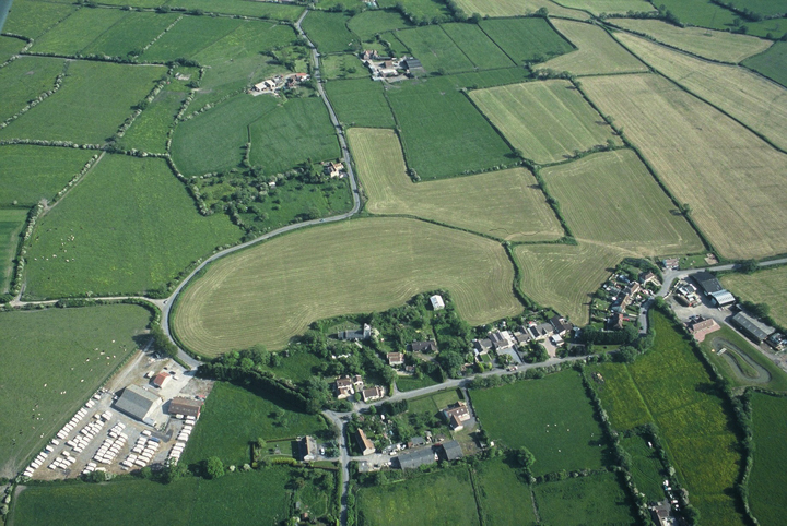
Around the 10th century people started to settle on the marshes for a second time. The earliest evidence is a series of oval-shaped enclosures, surrounded by a bank and ditch, of which there is a particularly fine example at Puxton [Figure 2]. These were designed to protect small areas of agricultural land from unusually high summer floods, but by the 11th century sea walls were once again built along the coast to protect the North Somerset Levels all year round. Settlements soon grew up and Puxton developed into a village of perhaps 30 households. Their church, with a remarkable leaning tower, is now redundant but cared for by the Church Conservation Trust (http://www.visitchurches.org.uk/).
Visit details.
Click to enlarge an image - click left side for previous, right for next.